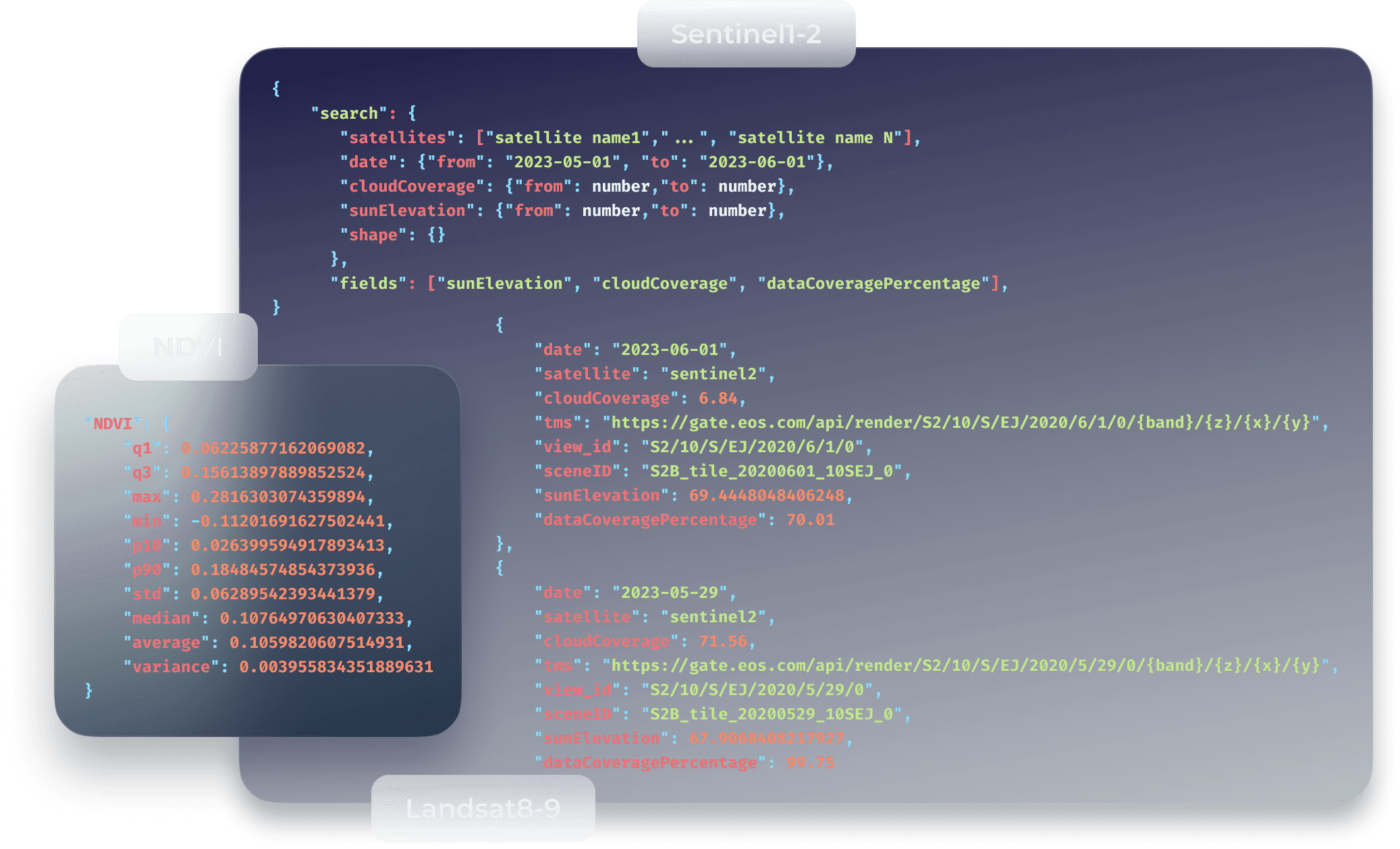
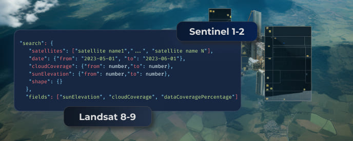
EOSDA API Connect Documentation
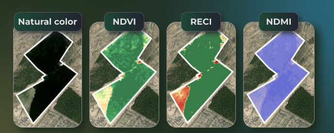
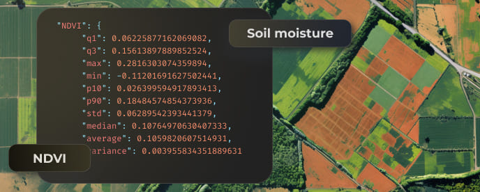
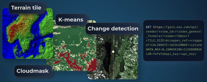
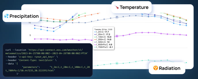
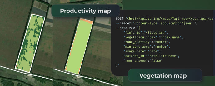
Access Sentinel, Landsat, and other Earth observation imagery for high-quality analytics, including precise vegetation indices and real-time weather data. Easily integrate into third-party tools for comprehensive geospatial insights. Explore our detailed Satellite API Documentation to get started.
Build with EOSDA API Connect
Feeling ready?
Launch your API trial or connect with our support team for personalized assistance